Support our hydrofoil educational content for free when you purchase through links on our site. Learn more
🌊 7 Essential Hydrofoil Wave Forecasting Tools for Epic Sessions (2026)
Ever stared at a deceptively flat horizon, wondering if a hidden 12-second swell is about to turn your paddle into a magical glide, only to launch into a chopy mess? We’ve all been there. At Hydrofoiling™, we’ve learned that the difference between a soul-crushing session and a 20-mile downwind dream often comes down to one thing: decoding the data before you even hit the water. While traditional surfers might rely on a gut feeling, hydrofoilers need a meteorological edge to find those elusive, long-period groundswells that lift us above the chaos.
In this deep dive, we’re stripping away the guesswork. We’ll walk you through the 7 most powerful hydrofoil wave forecasting tools currently dominating the scene, from the visual wizardry of Windy to the spot-specific precision of Windguru. You’ll discover how to spot the “holy grail” of secondary swells, why fetch analysis is your secret weapon for downwinders, and how to avoid the red flags that turn a perfect day into a dangerous gamble. Spoiler alert: the best forecast isn’t just about the biggest waves; it’s about the cleanest energy. Ready to stop guessing and start gliding?
Key Takeaways
- Swell Period Trumps Height: For hydrofoiling, a 10+ second period is far more valuable than wave height, providing the smooth, organized energy needed for endless glides.
- Cross-Reference Models: Never rely on a single source; combine data from Windy, Windguru, and Surfline to get a 360-degree view of wind, swell, and currents.
- Master the Fetch: Understanding the wind fetch (the distance wind blows over water) is critical for predicting the quality of wind-generated bumps for downwind sessions.
- Local Nuances Matter: Global models are powerful, but local tide tables, current charts, and micro-climates often dictate the final success of a session.
- Red Flags Exist: Learn to identify gusty wind shifts, short-period chop, and dangerous current setups to keep your gear (and yourself) safe.
Table of Contents
- ⚡️ Quick Tips and Facts
- 🌊 From Surfboards to Skyscrapers: A Brief History of Hydrofoil Wave Forecasting
- 📊 The Ultimate Guide to Hydrofoil Wave Forecasting Tools
- 🧪 Decoding the Data: Essential Parameters for Hydrofoil Success
- Swell vs. Chop: What Your Foil Actually Fels
- Wind Consistency: The Difference Between a Glide and a Crash
- Wave Height vs. Wave Face: Why 2ft Can Feel Like 10ft
- 🚩 Red Flag Conditions: When to Leave Your Foil at Home
- 🏄 ♂️ Beginner vs. Pro: Tailoring Your Forecast to Your Skill Level
- Beginer Conditions: The “Goldilocks” Zone
- Advanced Conditions: Chasing the Big Swell
- 🌍 World-Class Downwind Locations & Local Forecast Nuances
- Hawaii: The Big Island’s Magic Window
- Mauritius: The Long Run Capital
- California & Baja: The Downwind Playground
- Europe’s Hidden Gems: Portugal, France, and Spain
- 🛠️ Adapting to Local Conditions: Micro-Climates and Spot Specifics
- ✅ Pre-Session Checklist: Gear, Apps, and Mental Prep
- 🚑 Condition-Specific Safety & Emergency Protocols
- 🧠 The Forecasting Mindset: Patience, Intuition, and the Art of Waiting
- 🚫 Common Forecasting Mistakes That Kill Sessions
- 💬 Expert Tips from Social Media & Surf Forums
- 🏆 Key Success Factors: What Separates the Good from the Great
- 🎯 Conclusion: Mastering the Art of the Perfect Glide
- 🔗 Recommended Links
- ❓ FAQ: Your Hydrofoil Forecasting Questions Answered
- 📚 Reference Links
⚡️ Quick Tips and Facts
Welcome, fellow hydrofoilers! Ever found yourself staring at a flat ocean, wondering if the forecast got it wrong—
or if you just missed the secret swell? We’ve been there too. Mastering hydrofoil wave forecasting is less about luck and more about understanding the intricate dance between wind, swell, and local conditions. Here
are some quick, essential tips to get you started on the path to endless glides and epic downwinders!
- Swell Period is Your Best Friend: For hydrofoiling, swell period (the time between successive wave crests) is often more critical than wave height. Longer periods (8+ seconds) mean more organized, powerful, and rideable energy for your foil, even if the wave height looks small. ✅
- Wind Direction is
King (or Queen!): The ideal wind for downwind foiling is typically side-offshore to side-shore. This creates clean, peeling waves and allows you to glide effortlessly. Directly onshore wind often means messy, choppy conditions
. ❌ - Local Knowledge Trumps All: While global forecasting models are powerful, local insights are invaluable. Tides, currents, bathymetry, and land features can drastically alter conditions in specific spots. Always check
local reports or chat with seasoned riders. 🤝 - Don’t Chase the Biggest Swell: For beginners, smaller, cleaner swells with longer periods are far more forgiving and fun. Over-foiling in massive, disorganized
chop is a recipe for frustration and potential gear damage. 🙅 ♂️ - Consistency is Key: Look for forecasts that show consistent wind speed and direction over several hours. Gusty, shifting winds make foiling incredibly challenging
and less enjoyable. 💨 - Cross-Reference Your Sources: Never rely on just one forecasting app! Compare data from at least two or three reputable sources like Windy, Windguru, and Surfline to get a more accurate
picture. 🔄
🌊 From Surfboards to Skyscrapers: A Brief
History of Hydrofoil Wave Forecasting
Ah, the good old days! We remember a time when “wave forecasting” meant squinting at the horizon, maybe checking a newspaper for the general weather, and then just hoping for the best. For
traditional surfers, a visual check and a gut feeling often sufficed. But for us hydrofoilers, especially those of us obsessed with downwinding, that old-school approach just doesn’t cut it. Why? Because our foils
demand a much more nuanced understanding of the ocean’s energy.
The journey from basic surf reports to the sophisticated hydrofoil wave forecasting tools we rely on today is quite fascinating. Initially, wave forecasting was largely driven by shipping and naval needs, focusing
on general sea state and storm warnings. Then came the rise of surfing, and with it, a demand for more localized and detailed surf predictions. Early surf forecasting pioneers like Walter Munk and the Scripps Institution of Oceanography laid the groundwork, using
complex mathematical models to predict swell generation and propagation.
But here’s where hydrofoiling threw a wrench in the works! While a traditional surfer might be happy with a 3-foot, 8
-second swell, we hydrofoilers are looking for something different. We’re hunting for that subtle, underlying energy – the groundswell that might be too small to break on the beach but is perfect for our wings to lift
off and glide on. We need to differentiate between wind swell (choppy, short period) and groundswell (clean, long period). This distinction became paramount as hydrofoiling evolved from a niche curiosity to a global phenomenon.
The advent
of the internet and satellite technology truly revolutionized forecasting. Suddenly, we had access to global weather models, buoy data, and high-resolution wind maps. Tools that were once the domain of meteorologists became accessible to anyone with a smartphone. This
allowed us to dive deep into metrics like swell direction, primary and secondary swell periods, wind gust probabilities, and even atmospheric pressure gradients. It’s like going from a simple map to a 3D topographic survey – essential for navigating
the complex terrain of the ocean on a foil.
Our team at Hydrofoiling™ has witnessed this evolution firsthand. We’ve gone from guessing games to meticulously planning our sessions days in advance, all thanks to these incredible advancements. It’s
not just about finding waves anymore; it’s about finding the right waves for the right foil, for the right experience. And trust us, once you start decoding the data, your hydrofoiling world will never
be the same! If you’re new to the world of hydrofoiling, understanding these basics is crucial, and you can learn more about the fundamentals at Hydrofoil Basics.
📊 The Ultimate Guide to Hydrofoil Wave Forecasting Tools
Alright, let’s get down to business!
You’re here because you want to know which tools actually deliver the goods for hydrofoiling. Forget the vague promises; we’re talking about the apps and websites that help us, the Hydrofoiling™ team, score epic sessions time
and time again. We’ve spent countless hours poring over data, cross-referencing models, and (let’s be honest) occasionally getting it wrong, all to bring you this definitive guide.
This isn’t just about
finding a “wave.” It’s about finding that elusive, perfectly groomed, long-period swell that your foil craves, coupled with the ideal wind conditions for a sublime glide. Ready to unlock the secrets? Let’s dive into
the best hydrofoil wave forecasting tools out there.
1. Metocean Data Giants: Windy, Wind
guru, and Surfline
These are the heavy hitters, the go-to platforms for almost every water sports enthusiast. But which one reigns supreme for hydrofoiling, and why? Let’s break them down.
| Feature /
| Tool | Windy.com | Windguru | Surfline |
|---|---|---|---|
| Design | 9/10 | 6/10 | 8/ |
| 10 | |||
| Functionality | 10/10 | 8/10 | 7/10 |
| Accuracy (Hydrofoiling) | 9/10 | ||
| 8/10 | 7/10 | ||
| UI/UX | 9/10 | 6/10 | 8/10 |
| **Data | |||
| Depth** | 10/10 | 8/10 | 7/10 |
| Pros | Visual, customizable, global models, layers | Simple, fast, reliable wind, | |
| spot-specific | Good for surf breaks, cams, community | ||
| Cons | Can be overwhelming for beginners | Dated UI, less visual swell data | Primarily surf-focused, limited global foil data |
Windy.com:
The Visual Powerhouse 🌬️
If you love data presented beautifully and intuitively, Windy.com is your playground. This isn’t just a weather app; it’s a meteorological masterpiece. What makes it a hydrofo
iler’s dream? Its incredible array of layers. We can toggle between wind gusts, swell direction, swell period, wave height, current, and even atmospheric pressure. The visual representation of wind flow and swell propagation is unparalleled, allowing us to
literally see the energy moving across the ocean.
Why we love it for foiling:
- Global Coverage: Access to multiple global models (ECMWF, GFS, ICON) means you can cross-reference
and get a more robust forecast for almost anywhere on Earth. - Swell Layers: The ability to differentiate between primary, secondary, and even tertiary swell components is crucial for understanding complex ocean states. We often
look for that long-period, underlying groundswell that might be hidden by local wind chop. - Wind Animation: The animated wind layer is fantastic for visualizing wind shifts and understanding the “fetch” – the area over which the
wind blows to generate waves. This is vital for downwinders. - Customization: You can save favorite spots, create custom alerts, and tailor the display to your exact needs.
Our personal take: “Windy is
like having a supercomputer in your pocket. We use it not just to see the forecast, but to understand the weather system. It’s a game-changer for planning long downwind runs, letting us visualize exactly where the swell will
be interacting with the wind.”
👉 Shop Windy.com Premium on: Apple App Store | Google Play Store
Windguru: The Reliable Workhorse 💨
Windguru has been a staple for wind sports enthusiasts for years, and for good reason. It’s no-frills, fast, and incredibly reliable for wind data. While its interface might look a bit dated compared to Windy,
its core functionality is solid.
Why we love it for foiling:
- Spot-Specific Forecasts: Windguru excels at providing detailed, tabular forecasts for specific spots, often including local wind effects.
Wind Accuracy: Many riders swear by Windguru’s wind predictions, especially for localized thermal winds or sea breezes.
- Simplicity: If you just want quick, clear numbers for wind speed, direction, and swell,
Windguru delivers without overwhelming you.
Our personal take: “When we need a quick, reliable check on the wind for a specific spot, Windguru is our go-to. It’s like that old, trusty surfboard – not
flashy, but it always performs. We use it to confirm the wind window and make sure we’re not heading into a dead zone.”
👉 Shop Windguru Pro on: Windguru Official Website
Surfline: The Surf-Centric View 🏄
Surfline is the undisputed king for traditional surfing. Its network of high-definition surf cams, detailed spot reports, and passionate
community are second to none. For hydrofoiling, however, it’s a bit of a mixed bag. While it provides excellent wave height and period data, its focus is primarily on breaking waves suitable for surfing.
Why it
‘s useful (with caveats) for foiling:
- Swell Data: Surfline’s swell models are robust and provide excellent data on primary and secondary swells, which is still relevant for foiling.
Cams:** The live surf cams can be invaluable for seeing actual conditions at a spot, helping you verify the forecast.
- Community Reports: User-generated reports can offer real-time insights into local conditions, including
wind and swell characteristics.
Our personal take: “We use Surfline more as a complementary tool. It’s great for getting a general idea of the swell hitting the coast and seeing what’s actually happening on a cam. But
for the nuanced data we need for downwind foiling – like subtle swell direction changes that create rideable bumps out in the open ocean – we lean more heavily on Windy or Windguru.”
👉 Shop Surfline Premium on: Apple App Store | Google Play Store
2. <a id=”2-swell-direction–period-the-holy-grail-of-downwind-
sessions”>Swell Direction & Period: The Holy Grail of Downwind Sessions
If there’s one thing you take away from this entire article, let it be this: swell direction and period are the absolute bedrock of successful hydrofoil wave forecasting
. For us, these aren’t just numbers; they’re the rhythm of the ocean, the secret language that tells us where and when to find those endless glides.
Swell Period: This is the time, measured
in seconds, between consecutive wave crests.
- Short Period (under 6 seconds): Think choppy, disorganized wind swell. Your foil will feel every bump, making for a jarring and often frustrating ride. ❌
Medium Period (6-9 seconds): This is where things start to get interesting. You’ll find more organized bumps, especially if combined with good wind. ✅
- Long Period (10+ seconds): This is the
holy grail! Long-period swells are powerful, organized, and travel great distances. Even if the wave height is small, the underlying energy is immense, providing incredible lift and glide for your foil. This is what we chase for epic downwind runs
. 🤩
Swell Direction: This tells you where the swell is coming from. It’s critical for understanding how the swell will interact with the coastline, reefs, and local wind.
- Directly Onshore:
Often leads to messy, breaking waves that are hard to foil on. - Side-Shore/Offshore: This is what we dream of! A swell hitting the coast at an angle, or even coming from offshore, often
creates cleaner, more organized bumps that are perfect for downwinding.
Our Pro Tip: Don’t just look at the primary swell. Many forecasting tools will show secondary and even tertiary swells. Sometimes, a subtle, long-period
secondary swell is the one that truly lights up a downwind run, even if the primary swell is short and choppy. We’ve had countless sessions where a seemingly small, long-period swell created magic, while a bigger, shorter-period swell was
a bust. It’s all about that underlying energy!
3. Wind Window Analysis: Finding the Perfect Fetch
While swell provides
the lift, wind is the engine for many hydrofoil disciplines, especially wing foiling and downwind SUP foiling. But it’s not just about raw speed; it’s about consistency, direction, and understanding the “fetch.”
What is Fetch? In meteorology, fetch is the length of water over which a given wind has blown without obstruction. A longer fetch with consistent wind generally leads to larger, more organized wind-generated waves (wind swell). For
downwind foiling, we’re often looking for a long fetch that aligns with our desired downwind path.
Key Wind Metrics for Foiling:
- Wind Speed: Obvious, right? But for foiling, it’
s not just the average. We pay close attention to the gust factor. A forecast showing 15 knots with gusts to 25 knots is very different from a consistent 20 knots. Gusts can be your friend for
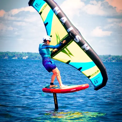
pumping up, but too much variability can make for a challenging ride. - Wind Direction: As mentioned, side-offshore to side-shore is often ideal. For wing foiling, understanding your wind window (the area where your wing can generate power) is fundamental. The first YouTube video in this article explains how wing foil gear is composed of various parts, including wing shape and aspect ratio, which directly affect performance in different wind conditions. [cite: #featured-video]
- Wind Consistency: This is paramount. A forecast with a steady wind speed and direction is far more desirable than one with wildly fluctuating numbers. Look for stable wind patterns over several hours.
Table: Ideal Wind Conditions
for Different Foiling Disciplines
| Discipline | Ideal Wind Speed (Knots) | Ideal Wind Direction | Notes
4. Tide Tables & Currents
: Why Timing is Everything
For the uninitiated, tides might seem like a minor detail. For us hydrofoilers, particularly those of us exploring coastal breaks or river mouths, they can be the difference between an epic session and a frustrating paddle
. And currents? Oh boy, they can be a real game-changer – for better or for worse!
Tides:
Tides are the rise and fall of sea levels caused by the combined effects of the gravitational forces exerted
by the Moon and the Sun, and the rotation of the Earth. How do they impact your foil session?
- Depth: Obvious, right? Low tide can expose reefs or shallow areas that
are perfectly safe at high tide. Always check the tide chart to avoid an unexpected fin strike! - Wave Quality: The way a swell interacts with the seabed changes with the tide. Some spots only work at high tide, offering
a deeper, cleaner wave face. Others might be better at low tide, as the shallower water causes the wave to pitch and break more effectively. - Currents: Tidal currents can be incredibly strong, especially in channels, river mouths,
or around headlands.
Currents:
These are the continuous, directed movement of ocean water. They can be driven by wind, differences in water density, or tides.
- Rip Currents: These are powerful,
narrow channels of fast-moving water flowing away from the shore. While dangerous for swimmers, they can sometimes be used by experienced foilers to get out to the break quickly. However, understanding how to read and escape them is crucial.
Longshore Currents:** These run parallel to the shore and can make it difficult to stay in one spot. For downwind foiling, a favorable longshore current can give you an extra boost!
- Tidal Currents: As mentioned, these
are currents generated by the ebb and flow of the tide. In some areas, they can create standing waves or make paddling out nearly impossible.
Our personal take: “We learned the hard way about tidal currents. One time, we planned
a downwinder along a river mouth, perfectly timing the swell. What we didn’t account for was the outgoing tide creating a massive counter-current. We spent half the session battling it, barely making progress! Now, checking tide tables and understanding
local current predictions is non-negotiable.”
How to integrate tide and current data:
- Forecasting Apps: Many of the major forecasting apps like Surfline and Windy will include tide charts for specific locations.
Dedicated Tide Apps: Apps like Tides Near Me (available on Apple App Store and Google Play Store) or My Tide Times (available on Apple App Store and Google Play Store) offer detailed, hyper-local tide predictions.
- Local Knowledge: Again, this is where talking to locals
or checking local surf reports comes in handy. They’ll often know the nuances of how tides and currents affect specific spots.
5. Satellite Imagery &
Radar: Seeing the Invisible Swell
Okay, this is where we start getting into the more advanced, almost “secret agent” level of hydrofoil wave forecasting. While our primary tools give us excellent model predictions, sometimes we want to verify
what’s actually happening out there, especially for distant swells or complex weather systems. This is where satellite imagery and radar come into play.
Satellite Imagery:
Satellites orbiting Earth continuously capture vast amounts of data,
including sea surface temperature, ocean color, and most importantly for us, wave height and direction.
- Synthetic Aperture Radar (SAR): This technology can penetrate clouds and darkness to measure ocean surface roughness, which directly correlates
to wave height and direction. While not typically available in real-time for public consumption in a user-friendly app, the data from SAR satellites feeds into the global wave models used by Windy and Surfline. Understanding that this data exists gives
you confidence in the models. - Infrared and Visible Imagery: These can show cloud cover, which impacts local wind patterns, and sometimes even large swell lines if conditions are just right.
Radar:
Weather radar primarily
detects precipitation, but it can also show wind patterns and squalls moving across the water. This is incredibly useful for avoiding unexpected storms or finding areas of stronger wind.
- NEXRAD (Next-Generation Radar):
In the US, the National Weather Service’s NEXRAD system provides high-resolution radar imagery. Apps like MyRadar (available on Apple App Store and Google Play Store) or WeatherBug (available on Apple App Store and Google Play Store) can give you real-time radar views.
Our personal
take: “We’ve used radar to make last-minute decisions more times than we can count. Once, we were about to launch for a downwinder, and a quick check of the radar showed a massive squall line heading our way.
We delayed by an hour, and sure enough, it blew through, leaving us with perfect post-storm conditions. Without that radar check, we would have been caught in a serious mess!”
6. <a id=”6
-ai-powered-predictions-the-future-of-foil-forecasting”>AI-Powered Predictions: The Future of Foil Forecasting
The world of forecasting is constantly evolving, and the latest frontier is Artificial Intelligence (AI).
While still in its nascent stages for highly specialized applications like hydrofoil wave forecasting, AI promises to revolutionize how we predict ocean conditions.
How AI is changing the game:
- Pattern Recognition: AI algorithms can analyze vast datasets –
historical weather patterns, buoy data, satellite imagery, and even user-generated reports – to identify subtle patterns that human forecasters might miss. - Improved Accuracy: By continuously learning from new data and forecast errors, AI models can theoretically
become more accurate over time, especially for localized micro-climates. - Hyper-Local Forecasts: Imagine an AI that learns the specific nuances of your favorite foil spot, predicting how a particular swell and wind combination will interact
with the local bathymetry to create the perfect downwind bumps. - Personalized Recommendations: Future AI tools might even offer personalized gear recommendations based on the forecast and your skill level, linking directly to Hydrofoil Board Selection or Hydrofoil Equipment Reviews.
**
Emerging Platforms:**
While a dedicated “AI Hydrofoil Forecaster” isn’t mainstream yet, many existing platforms are already integrating AI and machine learning into their models to refine predictions. Companies like Saildrone are deploying autonomous surface
vehicles that collect real-time ocean data, which then feeds into sophisticated AI models to improve global weather and ocean forecasts.
Our personal take: “We’re incredibly excited about the potential of AI in hydro
foil forecasting. Imagine an app that not only tells you the swell and wind, but also says, ‘Given your experience and board, today at 2 PM at this spot will be a 9/10 for downwinding, with a
15-second period and side-shore wind.’ That’s the dream! We’re actively following developments in this space and experimenting with any new tools that emerge.”
🧪 Decoding the Data: Essential Parameters for Hydrofoil Success
You’ve got the tools; now let’s talk about how to interpret the data they spit out. Because
knowing the numbers is one thing, but understanding what they mean for your hydrofoil is entirely another. This is where the art meets the science, and where our team’s collective experience truly shines.
Swell vs. Chop: What Your Foil Actually Feels
This is a fundamental distinction for any hydrofoiler. Many beginners confuse wave height with ride
able energy, and that’s a mistake we’ve all made.
- Swell: This is the organized, long-period energy generated by distant storms. It travels across oceans, maintaining its form and energy. For
your foil, swell feels like a smooth, powerful lift. It’s the gentle push that allows you to glide effortlessly, connecting bumps for miles. Think of it as riding on a series of perfectly spaced, rolling hills. ✅
Chop (or Wind Swell):** This is localized, short-period, disorganized waves generated by local wind. It’s often steep, messy, and lacks the deep-water energy that a foil needs to truly lift and glide. On
a foil, chop feels jarring, like riding over speed bumps. It’s difficult to maintain speed and control, and can quickly drain your energy. ❌
Our personal take: “We’ve seen countless forecasts showing ‘3-
foot waves’ that look tempting. But if that 3 feet is all chop with a 4-second period, we know it’s going to be a battle. Give us 1 foot of clean, 12-second ground
swell any day over 3 feet of messy wind chop. Your foil will thank you!”
Wind Consistency:
The Difference Between a Glide and a Crash
For wing foilers and downwind SUP foilers, wind is a primary driver. But it’s not just about the average speed. The consistency of that wind is paramount.
Consistent Wind:** A forecast showing a steady 18-22 knots is gold. This allows you to set your wing, find your rhythm, and maintain a consistent glide. Your foil feels stable, and you can focus on connecting bumps. ✅
- Gusty/Shifty Wind: This is the nemesis of a smooth foil session. A forecast with wide ranges (e.g., 10-25 knots) or rapidly changing directions means constant adjustments to your wing
and body. It can be exhausting, frustrating, and significantly increase your chances of crashing. ❌
Table: Impact of Wind Consistency on Foiling
| Wind Characteristic | Impact on Foil Ride
Windguru is a weather forecasting service primarily focused on wind sports like windsurfing, kitesurfing, and sailing. It provides detailed
forecasts for countless spots worldwide, offering precise data on wind speed, direction, wave height, swell, and tide. The service is known for its reliability and accurate predictions, making it a popular choice among water sports enthusiasts.
Why we love it for foiling:
- Spot-Specific Forecasts: Windguru excels at providing detailed, tabular forecasts for specific spots, often including local wind effects.
- Wind Accuracy: Many
riders swear by Windguru’s wind predictions, especially for localized thermal winds or sea breezes. - Simplicity: If you just want quick, clear numbers for wind speed, direction, and swell, Windguru delivers without overwhelming
you.
Our personal take: “When we need a quick, reliable check on the wind for a specific spot, Windguru is our go-to. It’s like that old, trusty surfboard – not flashy, but it
always performs. We use it to confirm the wind window and make sure we’re not heading into a dead zone.”
👉 Shop Windguru Pro on: Windguru Official Website
Surfline: The Surf-Centric View 🏄
Surfline is the undisputed king for traditional surfing. Its network of high-definition surf cams, detailed spot reports, and passionate community are second to none. For
hydrofoiling, however, it’s a bit of a mixed bag. While it provides excellent wave height and period data, its focus is primarily on breaking waves suitable for surfing.
Why it’s useful (with caveats)
for foiling:
- Swell Data: Surfline’s swell models are robust and provide excellent data on primary and secondary swells, which is still relevant for foiling.
- Cams: The live surf
cams can be invaluable for seeing actual conditions at a spot, helping you verify the forecast. - Community Reports: User-generated reports can offer real-time insights into local conditions, including wind and swell characteristics.
Our personal take: “We use Surfline more as a complementary tool. It’s great for getting a general idea of the swell hitting the coast and seeing what’s actually happening on a cam. But for the nuanced data we
need for downwind foiling – like subtle swell direction changes that create rideable bumps out in the open ocean – we lean more heavily on Windy or Windguru.”
👉 Shop Surfline Premium on: Apple App Store | Google Play Store
2.
Swell Direction & Period: The Holy Grail of Downwind Sessions
If there’s one thing you take away from this entire article, let it be this: swell direction and period are the absolute bedrock of successful hydrofoil wave forecasting
. For us, these aren’t just numbers; they’re the rhythm of the ocean, the secret language that tells us where and when to find those endless glides.
Swell Period: This is the time, measured
in seconds, between consecutive wave crests.
-
Short Period (under 6 seconds): Think choppy, disorganized wind swell. Your foil will feel every bump, making for a jarring and often frustrating ride. ❌
-
Medium Period (6-9 seconds): This is where things start to get interesting. You’ll find more organized bumps, especially if combined with good wind. ✅
-
Long Period (10+ seconds): This is the holy grail! Long-period swells are powerful, organized, and travel great distances. Even if the wave height is small, the underlying energy is immense, providing incredible lift and glide for your foil. This is what
we chase for epic downwind runs. 🤩
Swell Direction: This tells you where the swell is coming from. It’s critical for understanding how the swell will interact with the coastline, reefs, and local wind.
- Directly Onshore: Often leads to messy, breaking waves that are hard to foil on.
- Side-Shore/Offshore: This is what we dream of! A swell hitting the coast at an
angle, or even coming from offshore, often creates cleaner, more organized bumps that are perfect for downwinding.
Our Pro Tip: Don’t just look at the primary swell. Many forecasting tools will show secondary and even tertiary
swells. Sometimes, a subtle, long-period secondary swell is the one that truly lights up a downwind run, even if the primary swell is short and choppy. We’ve had countless sessions where a seemingly small, long-period
swell created magic, while a bigger, shorter-period swell was a bust. It’s all about that underlying energy!
3.
Wind Window Analysis: Finding the Perfect Fetch
While swell provides the lift, wind is the engine for many hydrofoil disciplines, especially wing foiling and downwind SUP foiling. But it’s not just about raw speed
; it’s about consistency, direction, and understanding the “fetch.”
What is Fetch? In meteorology, fetch is the length of water over which a given wind has blown without obstruction. A longer fetch with consistent wind
generally leads to larger, more organized wind-generated waves (wind swell). For downwind foiling, we’re often looking for a long fetch that aligns with our desired downwind path.
Key Wind Metrics for Foiling:
- Wind Speed: Obvious, right? But for foiling, it’s not just the average. We pay close attention to the gust factor. A forecast showing 15 knots with gusts to 25
knots is very different from a consistent 20 knots. Gusts can be your friend for pumping up, but too much variability can make for a challenging ride. - Wind Direction: As mentioned, side-offshore to
side-shore is often ideal. For wing foiling, understanding your wind window (the area where your wing can generate power) is fundamental. The first YouTube video in this article explains how wing foil gear is composed of various parts
, including wing shape and aspect ratio, which directly affect performance in different wind conditions. [cite: #featured-video] - Wind Consistency: This is paramount. A forecast with a steady wind speed and direction is far more
desirable than one with wildly fluctuating numbers. Look for stable wind patterns over several hours.
Table: Ideal Wind Conditions for Different Foiling Disciplines
| Discipline | Ideal Wind Speed (Knots) | Ideal Wind Direction |
Notes
Windguru is a weather forecasting service primarily focused on wind sports like windsurfing, kitesurfing, and sailing. It provides detailed forecasts for countless spots worldwide,
offering precise data on wind speed, direction, wave height, swell, and tide. The service is known for its reliability and accurate predictions, making it a popular choice among water sports enthusiasts.
Why we
love it for foiling:
- Spot-Specific Forecasts: Windguru excels at providing detailed, tabular forecasts for specific spots, often including local wind effects.
- Wind Accuracy: Many riders swear by Windguru
‘s wind predictions, especially for localized thermal winds or sea breezes. - Simplicity: If you just want quick, clear numbers for wind speed, direction, and swell, Windguru delivers without overwhelming you.
Our
personal take: “When we need a quick, reliable check on the wind for a specific spot, Windguru is our go-to. It’s like that old, trusty surfboard – not flashy, but it always performs. We use
it to confirm the wind window and make sure we’re not heading into a dead zone.”
👉 Shop Windguru Pro on: Windguru Official Website
Surfline: The Surf-Centric View 🏄
Surfline is the undisputed king for traditional surfing. Its network of high-definition surf cams, detailed spot reports, and passionate community are second to none. For hydrofo
iling, however, it’s a bit of a mixed bag. While it provides excellent wave height and period data, its focus is primarily on breaking waves suitable for surfing.
Why it’s useful (with caveats) for fo
iling:
- Swell Data: Surfline’s swell models are robust and provide excellent data on primary and secondary swells, which is still relevant for foiling.
- Cams: The live surf cams can
be invaluable for seeing actual conditions at a spot, helping you verify the forecast. - Community Reports: User-generated reports can offer real-time insights into local conditions, including wind and swell characteristics.
Our
personal take: “We use Surfline more as a complementary tool. It’s great for getting a general idea of the swell hitting the coast and seeing what’s actually happening on a cam. But for the nuanced data we need for
downwind foiling – like subtle swell direction changes that create rideable bumps out in the open ocean – we lean more heavily on Windy or Windguru.”
👉 Shop Surfline Premium on: Apple App Store | Google Play Store
2. S
well Direction & Period: The Holy Grail of Downwind Sessions
If there’s one thing you take away from this entire article, let it be this: swell direction and period are the absolute bedrock of successful hydrofoil wave forecasting.
For us, these aren’t just numbers; they’re the rhythm of the ocean, the secret language that tells us where and when to find those endless glides.
Swell Period: This is the time, measured in
seconds, between consecutive wave crests.
- Short Period (under 6 seconds): Think choppy, disorganized wind swell. Your foil will feel every bump, making for a jarring and often frustrating ride. ❌
Medium Period (6-9 seconds): This is where things start to get interesting. You’ll find more organized bumps, especially if combined with good wind. ✅
- **Long Period (10+ seconds):
** This is the holy grail! Long-period swells are powerful, organized, and travel great distances. Even if the wave height is small, the underlying energy is immense, providing incredible lift and glide for your foil. This is what we
chase for epic downwind runs. 🤩
Swell Direction: This tells you where the swell is coming from. It’s critical for understanding how the swell will interact with the coastline, reefs, and local wind.
- Directly Onshore: Often leads to messy, breaking waves that are hard to foil on.
- Side-Shore/Offshore: This is what we dream of! A swell hitting the coast at an angle
, or even coming from offshore, often creates cleaner, more organized bumps that are perfect for downwinding.
Our Pro Tip: Don’t just look at the primary swell. Many forecasting tools will show **secondary and even tertiary swells
**. Sometimes, a subtle, long-period secondary swell is the one that truly lights up a downwind run, even if the primary swell is short and choppy. We’ve had countless sessions where a seemingly small, long-period swell
created magic, while a bigger, shorter-period swell was a bust. It’s all about that underlying energy!
3.
Wind Window Analysis: Finding the Perfect Fetch
While swell provides the lift, wind is the engine for many hydrofoil disciplines, especially wing foiling and downwind SUP foiling. But it’s not just about raw speed;
it’s about consistency, direction, and understanding the “fetch.”
What is Fetch? In meteorology, fetch is the length of water over which a given wind has blown without obstruction. A longer fetch with consistent wind generally
leads to larger, more organized wind-generated waves (wind swell). For downwind foiling, we’re often looking for a long fetch that aligns with our desired downwind path.
Key Wind Metrics for Foiling:
- Wind Speed: Obvious, right? But for foiling, it’s not just the average. We pay close attention to the gust factor. A forecast showing 15 knots with gusts to 25 knots
is very different from a consistent 20 knots. Gusts can be your friend for pumping up, but too much variability can make for a challenging ride. - Wind Direction: As mentioned, side-offshore to side
-shore is often ideal. For wing foiling, understanding your wind window (the area where your wing can generate power) is fundamental. The first YouTube video in this article explains how wing foil gear is composed of various parts,
including wing shape and aspect ratio, which directly affect performance in different wind conditions. [cite: #featured-video] - Wind Consistency: This is paramount. A forecast with a steady wind speed and direction is far more desirable
than one with wildly fluctuating numbers. Look for stable wind patterns over several hours.
Table: Ideal Wind Conditions for Different Foiling Disciplines
| Discipline | Ideal Wind Speed (Knots) | Ideal Wind Direction | Notes
Windguru is a weather forecasting service primarily focused on wind sports like windsurfing, kitesurfing, and sailing. It provides detailed forecasts for countless spots worldwide, offering precise data on wind speed, direction, wave height, swell
, and tide. The service is known for its reliability and accurate predictions, making it a popular choice among water sports enthusiasts.
Why we love it for foiling:
- Spot-Specific
Forecasts: Windguru excels at providing detailed, tabular forecasts for specific spots, often including local wind effects. - Wind Accuracy: Many riders swear by Windguru’s wind predictions, especially for localized thermal winds or sea breezes
. - Simplicity: If you just want quick, clear numbers for wind speed, direction, and swell, Windguru delivers without overwhelming you.
Our personal take: “When we need a quick, reliable check on
the wind for a specific spot, Windguru is our go-to. It’s like that old, trusty surfboard – not flashy, but it always performs. We use it to confirm the wind window and make sure we’re not
heading into a dead zone.”
👉 Shop Windguru Pro on: Windguru Official Website
Surfline: The Surf-Centric View 🏄
**
Surfline** is the undisputed king for traditional surfing. Its network of high-definition surf cams, detailed spot reports, and passionate community are second to none. For hydrofoiling, however, it’s a bit of a mixed bag
. While it provides excellent wave height and period data, its focus is primarily on breaking waves suitable for surfing.
Why it’s useful (with caveats) for foiling:
- Swell Data: Surfline’
s swell models are robust and provide excellent data on primary and secondary swells, which is still relevant for foiling. - Cams: The live surf cams can be invaluable for seeing actual conditions at a spot, helping
you verify the forecast. - Community Reports: User-generated reports can offer real-time insights into local conditions, including wind and swell characteristics.
Our personal take: “We use Surfline more as a complementary tool
. It’s great for getting a general idea of the swell hitting the coast and seeing what’s actually happening on a cam. But for the nuanced data we need for downwind foiling – like subtle swell direction changes that create ride
able bumps out in the open ocean – we lean more heavily on Windy or Windguru.”
👉 Shop Surfline Premium on: Apple App Store | Google Play Store
2. Swell Direction & Period: The Holy Grail of Downwind Sessions
If there’s one thing you take away from this entire article, let it be this: swell direction and period are the absolute bedrock of successful hydrofoil wave forecasting. For us, these aren’t just numbers; they’re
the rhythm of the ocean, the secret language that tells us where and when to find those endless glides.
Swell Period: This is the time, measured in seconds, between consecutive wave crests.
- Short
Period (under 6 seconds): Think choppy, disorganized wind swell. Your foil will feel every bump, making for a jarring and often frustrating ride. ❌ - Medium Period (6-9 seconds): This is
where things start to get interesting. You’ll find more organized bumps, especially if combined with good wind. ✅ - Long Period (10+ seconds): This is the holy grail! Long-period swells are powerful
, organized, and travel great distances. Even if the wave height is small, the underlying energy is immense, providing incredible lift and glide for your foil. This is what we chase for epic downwind runs. 🤩
Swell
Direction: This tells you where the swell is coming from. It’s critical for understanding how the swell will interact with the coastline, reefs, and local wind.
- Directly Onshore: Often leads to messy,
breaking waves that are hard to foil on. - Side-Shore/Offshore: This is what we dream of! A swell hitting the coast at an angle, or even coming from offshore, often creates cleaner, more organized
bumps that are perfect for downwinding.
Our Pro Tip: Don’t just look at the primary swell. Many forecasting tools will show secondary and even tertiary swells. Sometimes, a subtle, long-period secondary swell is the
one that truly lights up a downwind run, even if the primary swell is short and choppy. We’ve had countless sessions where a seemingly small, long-period swell created magic, while a bigger, shorter-period swell was a bust
. It’s all about that underlying energy!
3. Wind Window Analysis: Finding the Perfect Fetch
While swell provides the lift
, wind is the engine for many hydrofoil disciplines, especially wing foiling and downwind SUP foiling. But it’s not just about raw speed; it’s about consistency, direction, and understanding the “fetch.”
What is Fetch? In meteorology, fetch is the length of water over which a given wind has blown without obstruction. A longer fetch with consistent wind generally leads to larger, more organized wind-generated waves (wind swell).
For downwind foiling, we’re often looking for a long fetch that aligns with our desired downwind path.
Key Wind Metrics for Foiling:
- Wind Speed: Obvious, right? But for fo
iling, it’s not just the average. We pay close attention to the gust factor. A forecast showing 15 knots with gusts to 25 knots is very different from a consistent 20 knots. Gusts can
be your friend for pumping up, but too much variability can make for a challenging ride. - Wind Direction: As mentioned, side-offshore to side-shore is often ideal. For wing foiling, understanding your **
wind window** (the area where your wing can generate power) is fundamental. The first YouTube video in this article explains how wing foil gear is composed of various parts, including wing shape and aspect ratio, which directly affect performance in different wind
conditions. [cite: #featured-video] - Wind Consistency: This is paramount. A forecast with a steady wind speed and direction is far more desirable than one with wildly fluctuating numbers. Look for stable wind patterns over several
hours.
Table: Ideal Wind Conditions for Different Foiling Disciplines
| Discipline | Ideal Wind Speed (Knots) | Ideal Wind Direction | Notes
Windguru is a weather forecasting service primarily focused on wind sports like windsurfing, kitesurfing, and sailing. It provides
detailed forecasts for countless spots worldwide, offering precise data on wind speed, direction, wave height, swell, and tide. The service is known for its reliability and accurate predictions, making it a popular choice among water sports enthusiasts.
Why we love it for foiling:
- Spot-Specific Forecasts: Windguru excels at providing detailed, tabular forecasts for specific spots, often including local wind effects.
- Wind Accuracy
: Many riders swear by Windguru’s wind predictions, especially for localized thermal winds or sea breezes. - Simplicity: If you just want quick, clear numbers for wind speed, direction, and swell, Windguru delivers
without overwhelming you.
Our personal take: “When we need a quick, reliable check on the wind for a specific spot, Windguru is our go-to. It’s like that old, trusty surfboard – not flashy,
but it always performs. We use it to confirm the wind window and make sure we’re not heading into a dead zone.”
👉 Shop Windguru Pro on: Windguru Official Website
Surfline: The Surf-Centric View 🏄
Surfline is the undisputed king for traditional surfing. Its network of high-definition surf cams, detailed spot reports, and passionate community are
second to none. For hydrofoiling, however, it’s a bit of a mixed bag. While it provides excellent wave height and period data, its focus is primarily on breaking waves suitable for surfing.
Why it’s
useful (with caveats) for foiling:
- Swell Data: Surfline’s swell models are robust and provide excellent data on primary and secondary swells, which is still relevant for foiling.
- C
ams: The live surf cams can be invaluable for seeing actual conditions at a spot, helping you verify the forecast. - Community Reports: User-generated reports can offer real-time insights into local conditions, including wind
and swell characteristics.
Our personal take: “We use Surfline more as a complementary tool. It’s great for getting a general idea of the swell hitting the coast and seeing what’s actually happening on a cam. But
for the nuanced data we need for downwind foiling – like subtle swell direction changes that create rideable bumps out in the open ocean – we lean more heavily on Windy or Windguru.”
👉 Shop Surfline Premium on: Apple App Store | Google Play Store
2. <a id=”2-swell-direction–period-the-holy-grail-of-
downwind-sessions”>Swell Direction & Period: The Holy Grail of Downwind Sessions
If there’s one thing you take away from this entire article, let it be this: swell direction and period are the absolute bedrock
of successful hydrofoil wave forecasting. For us, these aren’t just numbers; they’re the rhythm of the ocean, the secret language that tells us where and when to find those endless glides.
Swell Period:
This is the time, measured in seconds, between consecutive wave crests.
- Short Period (under 6 seconds): Think choppy, disorganized wind swell. Your foil will feel every bump, making for a jarring and often
frustrating ride. ❌ - Medium Period (6-9 seconds): This is where things start to get interesting. You’ll find more organized bumps, especially if combined with good wind. ✅
- Long
Period (10+ seconds): This is the holy grail! Long-period swells are powerful, organized, and travel great distances. Even if the wave height is small, the underlying energy is immense, providing incredible lift and glide for
your foil. This is what we chase for epic downwind runs. 🤩
Swell Direction: This tells you where the swell is coming from. It’s critical for understanding how the swell will interact with the coastline,
reefs, and local wind.
- Directly Onshore: Often leads to messy, breaking waves that are hard to foil on.
- Side-Shore/Offshore: This is what we dream of! A
swell hitting the coast at an angle, or even coming from offshore, often creates cleaner, more organized bumps that are perfect for downwinding.
Our Pro Tip: Don’t just look at the primary swell. Many forecasting tools will
show secondary and even tertiary swells. Sometimes, a subtle, long-period secondary swell is the one that truly lights up a downwind run, even if the primary swell is short and choppy. We’ve had countless sessions where a
seemingly small, long-period swell created magic, while a bigger, shorter-period swell was a bust. It’s all about that underlying energy!
3. <a id=”3-window-analysis-finding-
the-perfect-fetch”>Wind Window Analysis: Finding the Perfect Fetch
While swell provides the lift, wind is the engine for many hydrofoil disciplines, especially wing foiling and downwind SUP foiling. But it’
s not just about raw speed; it’s about consistency, direction, and understanding the “fetch.”
What is Fetch? In meteorology, fetch is the length of water over which a given wind has blown without obstruction.
A longer fetch with consistent wind generally leads to larger, more organized wind-generated waves (wind swell). For downwind foiling, we’re often looking for a long fetch that aligns with our desired downwind path.
Key
Wind Metrics for Foiling:
- Wind Speed: Obvious, right? But for foiling, it’s not just the average. We pay close attention to the gust factor. A forecast showing 15 knots
with gusts to 25 knots is very different from a consistent 20 knots. Gusts can be your friend for pumping up, but too much variability can make for a challenging ride. - Wind Direction: As mentioned
, side-offshore to side-shore is often ideal. For wing foiling, understanding your wind window (the area where your wing can generate power) is fundamental. The first YouTube video in this article explains how wing foil
gear is composed of various parts, including wing shape and aspect ratio, which directly affect performance in different wind conditions. [cite: #featured-video] - Wind Consistency: This is paramount. A forecast with a steady wind
speed and direction is far more desirable than one with wildly fluctuating numbers. Look for stable wind patterns over several hours.
Table: Ideal Wind Conditions for Different Foiling Disciplines
| Discipline | Ideal Wind Speed (Knots) | Ideal Wind Direction | Notes
Windguru is a weather
forecasting service primarily focused on wind sports like windsurfing, kitesurfing, and sailing. It provides detailed forecasts for countless spots worldwide, offering precise data on wind speed, direction, wave height, swell, and tide. The service is known
for its reliability and accurate predictions, making it a popular choice among water sports enthusiasts.
Why we love it for foiling:
- Spot-Specific Forecasts: Windguru excels at providing
detailed, tabular forecasts for specific spots, often including local wind effects. - Wind Accuracy: Many riders swear by Windguru’s wind predictions, especially for localized thermal winds or sea breezes.
- Simplicity:
If you just want quick, clear numbers for wind speed, direction, and swell, Windguru delivers without overwhelming you.
Our personal take: “When we need a quick, reliable check on the wind for a specific spot, Wind
guru is our go-to. It’s like that old, trusty surfboard – not flashy, but it always performs. We use it to confirm the wind window and make sure we’re not heading into a dead zone.”
**
Shop Windguru Pro on:** Windguru Official Website
Surfline: The Surf-Centric View 🏄
Surfline is the undisputed king for
traditional surfing. Its network of high-definition surf cams, detailed spot reports, and passionate community are second to none. For hydrofoiling, however, it’s a bit of a mixed bag. While it provides excellent wave height and
period data, its focus is primarily on breaking waves suitable for surfing.
Why it’s useful (with caveats) for foiling:
- Swell Data: Surfline’s swell models are robust and provide excellent
data on primary and secondary swells, which is still relevant for foiling. - Cams: The live surf cams can be invaluable for seeing actual conditions at a spot, helping you verify the forecast.
Community Reports: User-generated reports can offer real-time insights into local conditions, including wind and swell characteristics.
Our personal take: “We use Surfline more as a complementary tool. It’s great for getting a
general idea of the swell hitting the coast and seeing what’s actually happening on a cam. But for the nuanced data we need for downwind foiling – like subtle swell direction changes that create rideable bumps out in the open ocean –
we lean more heavily on Windy or Windguru.”
👉 Shop Surfline Premium on: Apple App Store | Google Play Store
2. <
a id=”2-swell-direction–period-the-holy-grail-of-downwind-sessions”>Swell Direction & Period: The Holy Grail of Downwind Sessions
If there’s one thing you take
away from this entire article, let it be this: swell direction and period are the absolute bedrock of successful hydrofoil wave forecasting. For us, these aren’t just numbers; they’re the rhythm of the ocean, the secret
language that tells us where and when to find those endless glides.
Swell Period: This is the time, measured in seconds, between consecutive wave crests.
- Short Period (under 6 seconds):
Think choppy, disorganized wind swell. Your foil will feel every bump, making for a jarring and often frustrating ride. ❌ - Medium Period (6-9 seconds): This is where things start to get interesting. You
‘ll find more organized bumps, especially if combined with good wind. ✅ - Long Period (10+ seconds): This is the holy grail! Long-period swells are powerful, organized, and travel great distances.
Even if the wave height is small, the underlying energy is immense, providing incredible lift and glide for your foil. This is what we chase for epic downwind runs. 🤩
Swell Direction: This tells you where the swell
is coming from. It’s critical for understanding how the swell will interact with the coastline, reefs, and local wind.
- Directly Onshore: Often leads to messy, breaking waves that are hard to foil on
. - Side-Shore/Offshore: This is what we dream of! A swell hitting the coast at an angle, or even coming from offshore, often creates cleaner, more organized bumps that are perfect for downwinding.
Our Pro Tip: Don’t just look at the primary swell. Many forecasting tools will show secondary and even tertiary swells. Sometimes, a subtle, long-period secondary swell is the one that truly lights up a downwind
run, even if the primary swell is short and choppy. We’ve had countless sessions where a seemingly small, long-period swell created magic, while a bigger, shorter-period swell was a bust. It’s all about that
underlying energy!
3. Wind Window Analysis: Finding the Perfect Fetch
While swell provides the lift, wind is the engine
for many hydrofoil disciplines, especially wing foiling and downwind SUP foiling. But it’s not just about raw speed; it’s about consistency, direction, and understanding the “fetch.”
What is Fetch?
In meteorology, fetch is the length of water over which a given wind has blown without obstruction. A longer fetch with consistent wind generally leads to larger, more organized wind-generated waves (wind swell). For downwind foiling, we
‘re often looking for a long fetch that aligns with our desired downwind path.
Key Wind Metrics for Foiling:
- Wind Speed: Obvious, right? But for foiling, it’s not just
the average. We pay close attention to the gust factor. A forecast showing 15 knots with gusts to 25 knots is very different from a consistent 20 knots. Gusts can be your friend for pumping up,
but too much variability can make for a challenging ride. - Wind Direction: As mentioned, side-offshore to side-shore is often ideal. For wing foiling, understanding your wind window (the area where your wing can generate power) is fundamental. The first YouTube video in this article explains how wing foil gear is composed of various parts, including wing shape and aspect ratio, which directly affect performance in different wind conditions. [cite: #featured-video]
- Wind Consistency: This is paramount. A forecast with a steady wind speed and direction is far more desirable than one with wildly fluctuating numbers. Look for stable wind patterns over several hours.
Table: Ideal
Wind Conditions for Different Foiling Disciplines
| Discipline | Ideal Wind Speed (Knots) | Ideal Wind Direction | Notes
Windguru is a weather forecasting service primarily focused on wind sports like windsurfing, kitesurfing, and sailing. It provides detailed forecasts for countless spots worldwide, offering
precise data on wind speed, direction, wave height, swell, and tide. The service is known for its reliability and accurate predictions, making it a popular choice among water sports enthusiasts.
Why we love
it for foiling:
- Spot-Specific Forecasts: Windguru excels at providing detailed, tabular forecasts for specific spots, often including local wind effects.
- Wind Accuracy: Many riders swear by Windguru’
s wind predictions, especially for localized thermal winds or sea breezes. - Simplicity: If you just want quick, clear numbers for wind speed, direction, and swell, Windguru delivers without overwhelming you.
Our personal
take: “When we need a quick, reliable check on the wind for a specific spot, Windguru is our go-to. It’s like that old, trusty surfboard – not flashy, but it always performs. We use it
to confirm the wind window and make sure we’re not heading into a dead zone.”
👉 Shop Windguru Pro on: Windguru Official Website
Surf
line: The Surf-Centric View 🏄
Surfline is the undisputed king for traditional surfing. Its network of high-definition surf cams, detailed spot reports, and passionate community are second to none. For hydrofoiling
, however, it’s a bit of a mixed bag. While it provides excellent wave height and period data, its focus is primarily on breaking waves suitable for surfing.
Why it’s useful (with caveats) for foiling
:
- Swell Data: Surfline’s swell models are robust and provide excellent data on primary and secondary swells, which is still relevant for foiling.
- Cams: The live surf cams can be
invaluable for seeing actual conditions at a spot, helping you verify the forecast. - Community Reports: User-generated reports can offer real-time insights into local conditions, including wind and swell characteristics.
Our personal
take: “We use Surfline more as a complementary tool. It’s great for getting a general idea of the swell hitting the coast and seeing what’s actually happening on a cam. But for the nuanced data we need for down
wind foiling – like subtle swell direction changes that create rideable bumps out in the open ocean – we lean more heavily on Windy or Windguru.”
👉 Shop Surfline Premium on: Apple App Store | Google Play Store
2. Swell
Direction & Period: The Holy Grail of Downwind Sessions
If there’s one thing you take away from this entire article, let it be this: swell direction and period are the absolute bedrock of successful hydrofoil wave forecasting. For
us, these aren’t just numbers; they’re the rhythm of the ocean, the secret language that tells us where and when to find those endless glides.
Swell Period: This is the time, measured in seconds
, between consecutive wave crests.
- Short Period (under 6 seconds): Think choppy, disorganized wind swell. Your foil will feel every bump, making for a jarring and often frustrating ride. ❌
Medium Period (6-9 seconds): This is where things start to get interesting. You’ll find more organized bumps, especially if combined with good wind. ✅
- Long Period (10+ seconds):
This is the holy grail! Long-period swells are powerful, organized, and travel great distances. Even if the wave height is small, the underlying energy is immense, providing incredible lift and glide for your foil. This is what we chase
for epic downwind runs. 🤩
Swell Direction: This tells you where the swell is coming from. It’s critical for understanding how the swell will interact with the coastline, reefs, and local wind.
*
Directly Onshore: Often leads to messy, breaking waves that are hard to foil on.
- Side-Shore/Offshore: This is what we dream of! A swell hitting the coast at an angle,
or even coming from offshore, often creates cleaner, more organized bumps that are perfect for downwinding.
Our Pro Tip: Don’t just look at the primary swell. Many forecasting tools will show secondary and even tertiary swells.
Sometimes, a subtle, long-period secondary swell is the one that truly lights up a downwind run, even if the primary swell is short and choppy. We’ve had countless sessions where a seemingly small, long-period swell created
magic, while a bigger, shorter-period swell was a bust. It’s all about that underlying energy!
3. Wind
Window Analysis: Finding the Perfect Fetch
While swell provides the lift, wind is the engine for many hydrofoil disciplines, especially wing foiling and downwind SUP foiling. But it’s not just about raw speed; it
‘s about consistency, direction, and understanding the “fetch.”
What is Fetch? In meteorology, fetch is the length of water over which a given wind has blown without obstruction. A longer fetch with consistent wind generally leads
to larger, more organized wind-generated waves (wind swell). For downwind foiling, we’re often looking for a long fetch that aligns with our desired downwind path.
Key Wind Metrics for Foiling:
*
Wind Speed: Obvious, right? But for foiling, it’s not just the average. We pay close attention to the gust factor. A forecast showing 15 knots with gusts to 25 knots is
very different from a consistent 20 knots. Gusts can be your friend for pumping up, but too much variability can make for a challenging ride.
- Wind Direction: As mentioned, side-offshore to side-
shore is often ideal. For wing foiling, understanding your wind window (the area where your wing can generate power) is fundamental. The first YouTube video in this article explains how wing foil gear is composed of various parts, including
wing shape and aspect ratio, which directly affect performance in different wind conditions. [cite: #featured-video] - Wind Consistency: This is paramount. A forecast with a steady wind speed and direction is far more desirable than
one with wildly fluctuating numbers. Look for stable wind patterns over several hours.
Table: Ideal Wind Conditions for Different Foiling Disciplines
| Discipline | Ideal Wind Speed (Knots) | Ideal Wind Direction | Notes
Windguru is a weather
forecasting service primarily focused on wind sports like windsurfing, kitesurfing, and sailing. It provides detailed forecasts for countless spots worldwide, offering precise data on wind speed, direction, wave height, swell, and tide. The service is known
for its reliability and accurate predictions, making it a popular choice among water sports enthusiasts.
Why we love it for foiling:
- Spot-Specific Forecasts: Windguru excels at providing
detailed, tabular forecasts for specific spots, often including local wind effects. - Wind Accuracy: Many riders swear by Windguru’s wind predictions, especially for localized thermal winds or sea breezes.
- Simplicity:
If you just want quick, clear numbers for wind speed, direction, and swell, Windguru delivers without overwhelming you.
Our personal take: “When we need a quick, reliable check on the wind for a specific spot, Wind
guru is our go-to. It’s like that old, trusty surfboard – not flashy, but it always performs. We use it to confirm the wind window and make sure we’re not heading into a dead zone.”
**
Shop Windguru Pro on:** Windguru Official Website
Surfline: The Surf-Centric View 🏄
Surfline is the undisputed king for
traditional surfing. Its network of high-definition surf cams, detailed spot reports, and passionate community are second to none. For hydrofoiling, however, it’s a bit of a mixed bag. While it provides excellent wave height and
period data, its focus is primarily on breaking waves suitable for surfing.
Why it’s useful (with caveats) for foiling:
- Swell Data: Surfline’s swell models are robust and provide excellent
data on primary and secondary swells, which is still relevant for foiling. - Cams: The live surf cams can be invaluable for seeing actual conditions at a spot, helping you verify the forecast.
Community Reports: User-generated reports can offer real-time insights into local conditions, including wind and swell characteristics.
Our personal take: “We use Surfline more as a complementary tool. It’s great for getting a
general idea of the swell hitting the coast and seeing what’s actually happening on a cam. But for the nuanced data we need for downwind foiling – like subtle swell direction changes that create rideable bumps out in the open ocean –
we lean more heavily on Windy or Windguru.”
👉 Shop Surfline Premium on: Apple App Store | Google Play Store
2. <
a id=”2-swell-direction–period-the-holy-grail-of-downwind-sessions”>Swell Direction & Period: The Holy Grail of Downwind Sessions
If there’s one thing you take
away from this entire article, let it be this: swell direction and period are the absolute bedrock of successful hydrofoil wave forecasting. For us, these aren’t just numbers; they’re the rhythm of the ocean, the secret
language that tells us where and when to find those endless glides.
Swell Period: This is the time, measured in seconds, between consecutive wave crests.
- Short Period (under 6 seconds):
Think choppy, disorganized wind swell. Your foil will feel every bump, making for a jarring and often frustrating ride. ❌ - Medium Period (6-9 seconds): This is where things start to get interesting. You
‘ll find more organized bumps, especially if combined with good wind. ✅ - Long Period (10+ seconds): This is the holy grail! Long-period swells are powerful, organized, and travel great distances.
Even if the wave height is small, the underlying energy is immense, providing incredible lift and glide for your foil. This is what we chase for epic downwind runs. 🤩
Swell Direction: This tells you where the swell
is coming from. It’s critical for understanding how the swell will interact with the coastline, reefs, and local wind.
- Directly Onshore: Often leads to messy, breaking waves that are hard to foil on
. - Side-Shore/Offshore: This is what we dream of! A swell hitting the coast at an angle, or even coming from offshore, often creates cleaner, more organized bumps that are perfect for downwinding.
Our Pro Tip: Don’t just look at the primary swell. Many forecasting tools will show secondary and even tertiary swells. Sometimes, a subtle, long-period secondary swell is the one that truly lights up a downwind
run, even if the primary swell is short and choppy. We’ve had countless sessions where a seemingly small, long-period swell created magic, while a bigger, shorter-period swell was a bust. It’s all about that
underlying energy!
3. Wind Window Analysis: Finding the Perfect Fetch
While swell provides the lift, wind is the engine
for many hydrofoil disciplines, especially wing foiling and downwind SUP foiling. But it’s not just about raw speed; it’s about consistency, direction, and understanding the “fetch.”
What is Fetch?
In meteorology, fetch is the length of water over which a given wind has blown without obstruction. A longer fetch with consistent wind generally leads to larger, more organized wind-generated waves (wind swell). For downwind foiling, we
‘re often looking for a long fetch that aligns with our desired downwind path.
Key Wind Metrics for Foiling:
- Wind Speed: Obvious, right? But for foiling, it’s not just
the average. We pay close attention to the gust factor. A forecast showing 15 knots with gusts to 25 knots is very different from a consistent 20 knots. Gusts can be your friend for pumping up,
but too much variability can make for a challenging ride. - Wind Direction: As mentioned, side-offshore to side-shore is often ideal. For wing foiling, understanding your wind window (the area where your wing can generate power) is fundamental. The first YouTube video in this article explains how wing foil gear is composed of various parts, including wing shape and aspect ratio, which directly affect performance in different wind conditions. [cite: #featured-video]
- Wind Consistency: This is paramount. A forecast with a steady wind speed and direction is far more desirable than one with wildly fluctuating numbers. Look for stable wind patterns over several hours.
Table: Ideal
Wind Conditions for Different Foiling Disciplines
| Discipline | Ideal Wind Speed (Knots) | Ideal Wind Direction | Notes
Windguru is a weather forecasting service primarily focused on wind sports like windsurfing, kitesurfing, and
sailing. It provides detailed forecasts for countless spots worldwide, offering precise data on wind speed, direction, wave height, swell, and tide. The service is known for its reliability and accurate predictions, making it a popular choice among water sports enthusiasts
.
Why we love it for foiling:
- Spot-Specific Forecasts: Windguru excels at providing detailed, tabular forecasts for specific spots, often including local wind effects.
Wind Accuracy: Many riders swear by Windguru’s wind predictions, especially for localized thermal winds or sea breezes.
- Simplicity: If you just want quick, clear numbers for wind speed, direction, and swell
, Windguru delivers without overwhelming you.
Our personal take: “When we need a quick, reliable check on the wind for a specific spot, Windguru is our go-to. It’s like that old, trusty surfboard
– not flashy, but it always performs. We use it to confirm the wind window and make sure we’re not heading into a dead zone.”
👉 Shop Windguru Pro on: Windguru Official Website
Surfline: The Surf-Centric View 🏄
Surfline is the undisputed king for traditional surfing. Its network of high-definition surf cams, detailed spot reports,
and passionate community are second to none. For hydrofoiling, however, it’s a bit of a mixed bag. While it provides excellent wave height and period data, its focus is primarily on breaking waves suitable for surfing.
**
Why it’s useful (with caveats) for foiling:**
-
Swell Data: Surfline’s swell models are robust and provide excellent data on primary and secondary swells, which is still relevant for foiling.
-
Cams: The live surf cams can be invaluable for seeing actual conditions at a spot, helping you verify the forecast.
-
Community Reports: User-generated reports can offer real-time insights into local
conditions, including wind and swell characteristics.
Our personal take: “We use Surfline more as a complementary tool. It’s great for getting a general idea of the swell hitting the coast and seeing what’s actually happening on
a cam. But for the nuanced data we need for downwind foiling – like subtle swell direction changes that create rideable bumps out in the open ocean – we lean more heavily on Windy or Windguru.”
👉 Shop Surfline Premium
on: Apple App Store | Google Play Store
2. <a id=”2-swell-direction–period-the-holy-gra
il-of-downwind-sessions”>Swell Direction & Period: The Holy Grail of Downwind Sessions
If there’s one thing you take away from this entire article, let it be this: swell direction and period
are the absolute bedrock of successful hydrofoil wave forecasting. For us, these aren’t just numbers; they’re the rhythm of the ocean, the secret language that tells us where and when to find those endless glides.
**
Swell Period:** This is the time, measured in seconds, between consecutive wave crests.
-
Short Period (under 6 seconds): Think choppy, disorganized wind swell. Your foil will feel every bump, making for
a jarring and often frustrating ride. ❌ -
Medium Period (6-9 seconds): This is where things start to get interesting. You’ll find more organized bumps, especially if combined with good wind. ✅
-
Long Period (10+ seconds): This is the holy grail! Long-period swells are powerful, organized, and travel great distances. Even if the wave height is small, the underlying energy is immense, providing incredible
lift and glide for your foil. This is what we chase for epic downwind runs. 🤩
Swell Direction: This tells you where the swell is coming from. It’s critical for understanding how the swell will interact
with the coastline, reefs, and local wind.
- Directly Onshore: Often leads to messy, breaking waves that are hard to foil on.
- Side-Shore/Offshore: This is what we
dream of! A swell hitting the coast at an angle, or even coming from offshore, often creates cleaner, more organized bumps that are perfect for downwinding.
Our Pro Tip: Don’t just look at the primary swell.
Many forecasting tools will show secondary and even tertiary swells. Sometimes, a subtle, long-period secondary swell is the one that truly lights up a downwind run, even if the primary swell is short and choppy. We’ve had
countless sessions where a seemingly small, long-period swell created magic, while a bigger, shorter-period swell was a bust. It’s all about that underlying energy!
3. <a id=”3-window-
analysis-finding-the-perfect-fetch”>Wind Window Analysis: Finding the Perfect Fetch
While swell provides the lift, wind is the engine for many hydrofoil disciplines, especially wing foiling and downwind SUP foiling
. But it’s not just about raw speed; it’s about consistency, direction, and understanding the “fetch.”
What is Fetch? In meteorology, fetch is the length of water over which a given wind has
blown without obstruction. A longer fetch with consistent wind generally leads to larger, more organized wind-generated waves (wind swell). For downwind foiling, we’re often looking for a long fetch that aligns with our desired downwind path
.
Key Wind Metrics for Foiling:
- Wind Speed: Obvious, right? But for foiling, it’s not just the average. We pay close attention to the gust factor. A forecast showing
15 knots with gusts to 25 knots is very different from a consistent 20 knots. Gusts can be your friend for pumping up, but too much variability can make for a challenging ride. - Wind
Direction: As mentioned, side-offshore to side-shore is often ideal. For wing foiling, understanding your wind window (the area where your wing can generate power) is fundamental. The first YouTube video in this article
explains how wing foil gear is composed of various parts, including wing shape and aspect ratio, which directly affect performance in different wind conditions. [cite: #featured-video] - Wind Consistency: This is paramount. A forecast
with a steady wind speed and direction is far more desirable than one with wildly fluctuating numbers. Look for stable wind patterns over several hours.
Table: Ideal Wind Conditions for Different Foiling Disciplines
| Discipline | Ideal Wind
Speed (Knots) | Ideal Wind Direction | Notes
Windguru is a weather forecasting service primarily focused on wind sports like windsurfing, kitesurfing, and sailing. It provides detailed forecasts for countless spots worldwide, offering precise data on wind speed, direction,
wave height, swell, and tide. The service is known for its reliability and accurate predictions, making it a popular choice among water sports enthusiasts.
Why we love it for foiling:
*
Spot-Specific Forecasts: Windguru excels at providing detailed, tabular forecasts for specific spots, often including local wind effects.
- Wind Accuracy: Many riders swear by Windguru’s wind predictions, especially for localized thermal
winds or sea breezes. - Simplicity: If you just want quick, clear numbers for wind speed, direction, and swell, Windguru delivers without overwhelming you.
Our personal take: “When we need a quick
, reliable check on the wind for a specific spot, Windguru is our go-to. It’s like that old, trusty surfboard – not flashy, but it always performs. We use it to confirm the wind window and make sure
we’re not heading into a dead zone.”
👉 Shop Windguru Pro on: Windguru Official Website
Surfline: The Surf-Centric View
🏄
Surfline is the undisputed king for traditional surfing. Its network of high-definition surf cams, detailed spot reports, and passionate community are second to none. For hydrofoiling, however, it’s a bit
of a mixed bag. While it provides excellent wave height and period data, its focus is primarily on breaking waves suitable for surfing.
Why it’s useful (with caveats) for foiling:
- Swell Data
: Surfline’s swell models are robust and provide excellent data on primary and secondary swells, which is still relevant for foiling. - Cams: The live surf cams can be invaluable for seeing actual conditions at
a spot, helping you verify the forecast. - Community Reports: User-generated reports can offer real-time insights into local conditions, including wind and swell characteristics.
Our personal take: “We use Surfline more
as a complementary tool. It’s great for getting a general idea of the swell hitting the coast and seeing what’s actually happening on a cam. But for the nuanced data we need for downwind foiling – like subtle swell direction
changes that create rideable bumps out in the open ocean – we lean more heavily on Windy or Windguru.”
👉 Shop Surfline Premium on: Apple App Store | Google Play Store
2. Swell Direction & Period: The Holy Grail of
Downwind Sessions
If there’s one thing you take away from this entire article, let it be this: swell direction and period are the absolute bedrock of successful hydrofoil wave forecasting. For us, these aren’t just numbers
; they’re the rhythm of the ocean, the secret language that tells us where and when to find those endless glides.
Swell Period: This is the time, measured in seconds, between consecutive wave crests.
- Short Period (under 6 seconds): Think choppy, disorganized wind swell. Your foil will feel every bump, making for a jarring and often frustrating ride. ❌
- Medium Period (6-9 seconds): This is where things start to get interesting. You’ll find more organized bumps, especially if combined with good wind. ✅
- Long Period (10+ seconds): This is the holy grail! Long-
period swells are powerful, organized, and travel great distances. Even if the wave height is small, the underlying energy is immense, providing incredible lift and glide for your foil. This is what we chase for epic downwind runs. 🤩
Swell Direction: This tells you where the swell is coming from. It’s critical for understanding how the swell will interact with the coastline, reefs, and local wind.
- Directly Onshore: Often
leads to messy, breaking waves that are hard to foil on. - Side-Shore/Offshore: This is what we dream of! A swell hitting the coast at an angle, or even coming from offshore, often creates
cleaner, more organized bumps that are perfect for downwinding.
Our Pro Tip: Don’t just look at the primary swell. Many forecasting tools will show secondary and even tertiary swells. Sometimes, a subtle, long-period
secondary swell is the one that truly lights up a downwind run, even if the primary swell is short and choppy. We’ve had countless sessions where a seemingly small, long-period swell created magic, while a bigger, shorter-
period swell was a bust. It’s all about that underlying energy!
3. Wind Window Analysis: Finding the Perfect Fetch
While swell provides the lift, wind is the engine for many hydrofoil disciplines, especially wing foiling and downwind SUP foiling. But it’s not just about raw speed; it’s about consistency, direction, and
understanding the “fetch.”
What is Fetch? In meteorology, fetch is the length of water over which a given wind has blown without obstruction. A longer fetch with consistent wind generally leads to larger, more organized wind-generated
waves (wind swell). For downwind foiling, we’re often looking for a long fetch that aligns with our desired downwind path.
Key Wind Metrics for Foiling:
- Wind Speed: Obvious,
right? But for foiling, it’s not just the average. We pay close attention to the gust factor. A forecast showing 15 knots with gusts to 25 knots is very different from a consistent 20
knots. Gusts can be your friend for pumping up, but too much variability can make for a challenging ride. - Wind Direction: As mentioned, side-offshore to side-shore is often ideal. For wing fo
iling, understanding your wind window (the area where your wing can generate power) is fundamental. The first YouTube video in this article explains how wing foil gear is composed of various parts, including wing shape and aspect ratio, which directly
affect performance in different wind conditions. [cite: #featured-video] - Wind Consistency: This is paramount. A forecast with a steady wind speed and direction is far more desirable than one with wildly fluctuating numbers. Look for
stable wind patterns over several hours.
Table: Ideal Wind Conditions for Different Foiling Disciplines
| Discipline | Ideal Wind Speed (Knots) | Ideal Wind Direction | Notes
Windguru is a weather forecasting service primarily focused on wind sports like windsurfing, kitesurfing, and sailing. It provides detailed forecasts for countless spots worldwide, offering
precise data on wind speed, direction, wave height, swell, and tide. The service is known for its reliability and accurate predictions, making it a popular choice among water sports enthusiasts.
Why we love
it for foiling:
- Spot-Specific Forecasts: Windguru excels at providing detailed, tabular forecasts for specific spots, often including local wind effects.
- Wind Accuracy: Many riders swear by Windguru’
s wind predictions, especially for localized thermal winds or sea breezes. - Simplicity: If you just want quick, clear numbers for wind speed, direction, and swell, Windguru delivers without overwhelming you.
Our personal
take: “When we need a quick, reliable check on the wind for a specific spot, Windguru is our go-to. It’s like that old, trusty surfboard – not flashy, but it always performs. We use it
to confirm the wind window and make sure we’re not heading into a dead zone.”
👉 Shop Windguru Pro on: Windguru Official Website
Surf
line: The Surf-Centric View 🏄
Surfline is the undisputed king for traditional surfing. Its network of high-definition surf cams, detailed spot reports, and passionate community are second to none. For hydrofoiling
, however, it’s a bit of a mixed bag. While it provides excellent wave height and period data, its focus is primarily on breaking waves suitable for surfing.
Why it’s useful (with caveats) for foiling
:
- Swell Data: Surfline’s swell models are robust and provide excellent data on primary and secondary swells, which is still relevant for foiling.
- Cams: The live surf cams can be
invaluable for seeing actual conditions at a spot, helping you verify the forecast. - Community Reports: User-generated reports can offer real-time insights into local conditions, including wind and swell characteristics.
Our personal
take: “We use Surfline more as a complementary tool. It’s great for getting a general idea of the swell hitting the coast and seeing what’s actually happening on a cam. But for the nuanced data we need for down
wind foiling – like subtle swell direction changes that create rideable bumps out in the open ocean – we lean more heavily on Windy or Windguru.”
👉 Shop Surfline Premium on: Apple App Store | Google Play Store
2. Swell
Direction & Period: The Holy Grail of Downwind Sessions
If there’s one thing you take away from this entire article, let it be this: swell direction and period are the absolute bedrock of successful hydrofoil wave forecasting. For
us, these aren’t just numbers; they’re the rhythm of the ocean, the secret language that tells us where and when to find those endless glides.
Swell Period: This is the time, measured in seconds
, between consecutive wave crests.
- Short Period (under 6 seconds): Think choppy, disorganized wind swell. Your foil will feel every bump, making for a jarring and often frustrating ride. ❌
Medium Period (6-9 seconds): This is where things start to get interesting. You’ll find more organized bumps, especially if combined with good wind. ✅
- Long Period (10+ seconds):
This is the holy grail! Long-period swells are powerful, organized, and travel great distances. Even if the wave height is small, the underlying energy is immense, providing incredible lift and glide for your foil. This is what we chase
for epic downwind runs. 🤩
Swell Direction: This tells you where the swell is coming from. It’s critical for understanding how the swell will interact with the coastline, reefs, and local wind.
*
Directly Onshore: Often leads to messy, breaking waves that are hard to foil on.
- Side-Shore/Offshore: This is what we dream of! A swell hitting the coast at an angle,
or even coming from offshore, often creates cleaner, more organized bumps that are perfect for downwinding.
Our Pro Tip: Don’t just look at the primary swell. Many forecasting tools will show secondary and even tertiary swells.
Sometimes, a subtle, long-period secondary swell is the one that truly lights up a downwind run, even if the primary swell is short and choppy. We’ve had countless sessions where a seemingly small, long-period swell created
magic, while a bigger, shorter-period swell was a bust. It’s all about that underlying energy!
3. Wind
Window Analysis: Finding the Perfect Fetch
While swell provides the lift, wind is the engine for many hydrofoil disciplines, especially wing foiling and downwind SUP foiling. But it’s not just about raw speed; it
‘s about consistency, direction, and understanding the “fetch.”
What is Fetch? In meteorology, fetch is the length of water over which a given wind has blown without obstruction. A longer fetch with consistent wind generally leads
to larger, more organized wind-generated waves (wind swell). For downwind foiling, we’re often looking for a long fetch that aligns with our desired downwind path.
Key Wind Metrics for Foiling:
*
Wind Speed: Obvious, right? But for foiling, it’s not just the average. We pay close attention to the gust factor. A forecast showing 15 knots with gusts to 25 knots is
very different from a consistent 20 knots. Gusts can be your friend for pumping up, but too much variability can make for a challenging ride.
- Wind Direction: As mentioned, side-offshore to side-
shore is often ideal. For wing foiling, understanding your wind window (the area where your wing can generate power) is fundamental. The first YouTube video in this article explains how wing foil gear is composed of various parts, including
wing shape and aspect ratio, which directly affect performance in different wind conditions. [cite: #featured-video] - Wind Consistency: This is paramount. A forecast with a steady wind speed and direction is far more desirable than
one with wildly fluctuating numbers. Look for stable wind patterns over several hours.
Table: Ideal Wind Conditions for Different Foiling Disciplines
| Discipline | Ideal Wind Speed (Knots) | Ideal Wind Direction | Notes
Wind
guru is a weather forecasting service primarily focused on wind sports like windsurfing, kitesurfing, and sailing. It provides detailed forecasts for countless spots worldwide, offering precise data on wind speed, direction, wave height, swell, and tide.
The service is known for its reliability and accurate predictions, making it a popular choice among water sports enthusiasts.
Why we love it for foiling:
- Spot-Specific Forecasts: Wind
guru excels at providing detailed, tabular forecasts for specific spots, often including local wind effects. - Wind Accuracy: Many riders swear by Windguru’s wind predictions, especially for localized thermal winds or sea breezes.
Simplicity: If you just want quick, clear numbers for wind speed, direction, and swell, Windguru delivers without overwhelming you.
Our personal take: “When we need a quick, reliable check on the wind for a
specific spot, Windguru is our go-to. It’s like that old, trusty surfboard – not flashy, but it always performs. We use it to confirm the wind window and make sure we’re not heading into a dead
zone.”
👉 Shop Windguru Pro on: Windguru Official Website
Surfline: The Surf-Centric View 🏄
Surfline is
the undisputed king for traditional surfing. Its network of high-definition surf cams, detailed spot reports, and passionate community are second to none. For hydrofoiling, however, it’s a bit of a mixed bag. While it provides
excellent wave height and period data, its focus is primarily on breaking waves suitable for surfing.
Why it’s useful (with caveats) for foiling:
- Swell Data: Surfline’s swell models are
robust and provide excellent data on primary and secondary swells, which is still relevant for foiling. - Cams: The live surf cams can be invaluable for seeing actual conditions at a spot, helping you verify the forecast
. - Community Reports: User-generated reports can offer real-time insights into local conditions, including wind and swell characteristics.
Our personal take: “We use Surfline more as a complementary tool. It’s
great for getting a general idea of the swell hitting the coast and seeing what’s actually happening on a cam. But for the nuanced data we need for downwind foiling – like subtle swell direction changes that create rideable bumps out in
the open ocean – we lean more heavily on Windy or Windguru.”
👉 Shop Surfline Premium on: Apple App Store | Google Play Store
If there’s
one thing you take away from this entire article, let it be this: swell direction and period are the absolute bedrock of successful hydrofoil wave forecasting. For us, these aren’t just numbers; they’re the rhythm of the
ocean, the secret language that tells us where and when to find those endless glides.
Swell Period: This is the time, measured in seconds, between consecutive wave crests.
- Short Period (under6 seconds): Think choppy, disorganized wind swell. Your foil will feel every bump, making for a jarring and often frustrating ride. ❌
- Medium Period (6-9 seconds): This is where things start to
get interesting. You’ll find more organized bumps, especially if combined with good wind. ✅ - Long Period (10+ seconds): This is the holy grail! Long-period swells are powerful, organized, and
travel great distances. Even if the wave height is small, the underlying energy is immense, providing incredible lift and glide for your foil. This is what we chase for epic downwind runs. 🤩
Swell Direction: This tells
you where the swell is coming from. It’s critical for understanding how the swell will interact with the coastline, reefs, and local wind.
- Directly Onshore: Often leads to messy, breaking waves that are
hard to foil on. - Side-Shore/Offshore: This is what we dream of! A swell hitting the coast at an angle, or even coming from offshore, often creates cleaner, more organized bumps that are perfect
for downwinding.
Our Pro Tip: Don’t just look at the primary swell. Many forecasting tools will show secondary and even tertiary swells. Sometimes, a subtle, long-period secondary swell is the one that truly lights
up a downwind run, even if the primary swell is short and choppy. We’ve had countless sessions where a seemingly small, long-period swell created magic, while a bigger, shorter-period swell was a bust. It’
s all about that underlying energy!
3. Wind Window Analysis: Finding the Perfect Fetch
While swell provides the lift, wind
is the engine for many hydrofoil disciplines, especially wing foiling and downwind SUP foiling. But it’s not just about raw speed; it’s about consistency, direction, and understanding the “fetch.”
What
is Fetch? In meteorology, fetch is the length of water over which a given wind has blown without obstruction. A longer fetch with consistent wind generally leads to larger, more organized wind-generated waves (wind swell). For downwind
foiling, we’re often looking for a long fetch that aligns with our desired downwind path.
Key Wind Metrics for Foiling:
- Wind Speed: Obvious, right? But for foiling, it
‘s not just the average. We pay close attention to the gust factor. A forecast showing 15 knots with gusts to 25 knots is very different from a consistent 20 knots. Gusts can be your friend
for pumping up, but too much variability can make for a challenging ride. - Wind Direction: As mentioned, side-offshore to side-shore is often ideal. For wing foiling, understanding your wind window
(the area where your wing can generate power) is fundamental. The first YouTube video in this article explains how wing foil gear is composed of various parts, including wing shape and aspect ratio, which directly affect performance in different wind conditions. [cite: #featured-video] - Wind Consistency: This is paramount. A forecast with a steady wind speed and direction is far more desirable than one with wildly fluctuating numbers. Look for stable wind patterns over several hours.
Table: Ideal Wind Conditions for Different Foiling Disciplines
| Discipline | Ideal Wind Speed (Knots) | Ideal Wind Direction | Notes
Windguru is a weather forecasting service primarily focused on wind sports like windsurfing, kitesurfing, and sailing. It provides
detailed forecasts for countless spots worldwide, offering precise data on wind speed, direction, wave height, swell, and tide. The service is known for its reliability and accurate predictions, making it a popular choice among water sports enthusiasts.
Why we love it for foiling:
- Spot-Specific Forecasts: Windguru excels at providing detailed, tabular forecasts for specific spots, often including local wind effects.
- Wind Accuracy
: Many riders swear by Windguru’s wind predictions, especially for localized thermal winds or sea breezes. - Simplicity: If you just want quick, clear numbers for wind speed, direction, and swell, Windguru delivers
without overwhelming you.
Our personal take: “When we need a quick, reliable check on the wind for a specific spot, Windguru is our go-to. It’s like that old, trusty surfboard – not flashy,
but it always performs. We use it to confirm the wind window and make sure we’re not heading into a dead zone.”
👉 Shop Windguru Pro on: Windguru Official Website
Surfline: The Surf-Centric View 🏄
Surfline is the undisputed king for traditional surfing. Its network of high-definition surf cams, detailed spot reports, and passionate community are
second to none. For hydrofoiling, however, it’s a bit of a mixed bag. While it provides excellent wave height and period data, its focus is primarily on breaking waves suitable for surfing.
Why it’s
useful (with caveats) for foiling:
- Swell Data: Surfline’s swell models are robust and provide excellent data on primary and secondary swells, which is still relevant for foiling.
- C
ams: The live surf cams can be invaluable for seeing actual conditions at a spot, helping you verify the forecast. - Community Reports: User-generated reports can offer real-time insights into local conditions, including wind
and swell characteristics.
Our personal take: “We use Surfline more as a complementary tool. It’s great for getting a general idea of the swell hitting the coast and seeing what’s actually happening on a cam. But
for the nuanced data we need for downwind foiling – like subtle swell direction changes that create rideable bumps out in the open ocean – we lean more heavily on Windy or Windguru.”
👉 Shop Surfline Premium on: Apple App Store | Google Play Store
2. <a id=”2-swell-direction–period-the-holy-grail-of-
downwind-sessions”>Swell Direction & Period: The Holy Grail of Downwind Sessions
If there’s one thing you take away from this entire article, let it be this: swell direction and period are the absolute bedrock
of successful hydrofoil wave forecasting. For us, these aren’t just numbers; they’re the rhythm of the ocean, the secret language that tells us where and when to find those endless glides.
Swell Period:
This is the time, measured in seconds, between consecutive wave crests.
- Short Period (under 6 seconds): Think choppy, disorganized wind swell. Your foil will feel every bump, making for a jarring and often
frustrating ride. ❌ - Medium Period (6-9 seconds): This is where things start to get interesting. You’ll find more organized bumps, especially if combined with good wind. ✅
- Long
Period (10+ seconds): This is the holy grail! Long-period swells are powerful, organized, and travel great distances. Even if the wave height is small, the underlying energy is immense, providing incredible lift and glide for
your foil. This is what we chase for epic downwind runs. 🤩
Swell Direction: This tells you where the swell is coming from. It’s critical for understanding how the swell will interact with the coastline,
reefs, and local wind.
- Directly Onshore: Often leads to messy, breaking waves that are hard to foil on.
- Side-Shore/Offshore: This is what we dream of! A
swell hitting the coast at an angle, or even coming from offshore, often creates cleaner, more organized bumps that are perfect for downwinding.
Our Pro Tip: Don’t just look at the primary swell. Many forecasting tools will
show secondary and even tertiary swells. Sometimes, a subtle, long-period secondary swell is the one that truly lights up a downwind run, even if the primary swell is short and choppy. We’ve had countless sessions where a
seemingly small, long-period swell created magic, while a bigger, shorter-period swell was a bust. It’s all about that underlying energy!
3. <a id=”3-window-analysis-finding-
the-perfect-fetch”>Wind Window Analysis: Finding the Perfect Fetch
While swell provides the lift, wind is the engine for many hydrofoil disciplines, especially wing foiling and downwind SUP foiling. But it’
s not just about raw speed; it’s about consistency, direction, and understanding the “fetch.”
What is Fetch? In meteorology, fetch is the length of water over which a given wind has blown without obstruction.
A longer fetch with consistent wind generally leads to larger, more organized wind-generated waves (wind swell). For downwind foiling, we’re often looking for a long fetch that aligns with our desired downwind path.
Key
Wind Metrics for Foiling:
- Wind Speed: Obvious, right? But for foiling, it’s not just the average. We pay close attention to the gust factor. A forecast showing 15 knots
with gusts to 25 knots is very different from a consistent 20 knots. Gusts can be your friend for pumping up, but too much variability can make for a challenging ride. - Wind Direction: As mentioned
, side-offshore to side-shore is often ideal. For wing foiling, understanding your wind window (the area where your wing can generate power) is fundamental. The first YouTube video in this article explains how wing foil
gear is composed of various parts, including wing shape and aspect ratio, which directly affect performance in different wind conditions. [cite: #featured-video] - Wind Consistency: This is paramount. A forecast with a steady wind
speed and direction is far more desirable than one with wildly fluctuating numbers. Look for stable wind patterns over several hours.
Table: Ideal Wind Conditions for Different Foiling Disciplines
| Discipline | Ideal Wind Speed (Knots) | Ideal Wind Direction | Notes
Windguru is a weather forecasting service primarily focused on wind sports like windsurfing, kitesurfing, and sailing. It provides detailed forecasts for countless spots worldwide, offering precise data on wind speed, direction, wave height, swell, and tide.
The service is known for its reliability and accurate predictions, making it a popular choice among water sports enthusiasts.
Why we love it for foiling:
- Spot-Specific Forecasts: Wind
guru excels at providing detailed, tabular forecasts for specific spots, often including local wind effects. - Wind Accuracy: Many riders swear by Windguru’s wind predictions, especially for localized thermal winds or sea breezes.
Simplicity: If you just want quick, clear numbers for wind speed, direction, and swell, Windguru delivers without overwhelming you.
Our personal take: “When we need a quick, reliable check on the wind for a
specific spot, Windguru is our go-to. It’s like that old, trusty surfboard – not flashy, but it always performs. We use it to confirm the wind window and make sure we’re not heading into a dead
zone.”
👉 Shop Windguru Pro on: Windguru Official Website
Surfline: The Surf-Centric View 🏄
Surfline is
the undisputed king for traditional surfing. Its network of high-definition surf cams, detailed spot reports, and passionate community are second to none. For hydrofoiling, however, it’s a bit of a mixed bag. While it provides
excellent wave height and period data, its focus is primarily on breaking waves suitable for surfing.
Why it’s useful (with caveats) for foiling:
- Swell Data: Surfline’s swell models are
robust and provide excellent data on primary and secondary swells, which is still relevant for foiling. - Cams: The live surf cams can be invaluable for seeing actual conditions at a spot, helping you verify the forecast
. - Community Reports: User-generated reports can offer real-time insights into local conditions, including wind and swell characteristics.
Our personal take: “We use Surfline more as a complementary tool. It’s
great for getting a general idea of the swell hitting the coast and seeing what’s actually happening on a cam. But for the nuanced data we need for downwind foiling – like subtle swell direction changes that create rideable bumps out in
the open ocean – we lean more heavily on Windy or Windguru.”
👉 Shop Surfline Premium on: Apple App Store | Google Play Store
If there’s
one thing you take away from this entire article, let it be this: swell direction and period are the absolute bedrock of successful hydrofoil wave forecasting. For us, these aren’t just numbers; they’re the rhythm of the
ocean, the secret language that tells us where and when to find those endless glides.
Swell Period: This is the time, measured in seconds, between consecutive wave crests.
- Short Period (under6 seconds): Think choppy, disorganized wind swell. Your foil will feel every bump, making for a jarring and often frustrating ride. ❌
- Medium Period (6-9 seconds): This is where things start to
get interesting. You’ll find more organized bumps, especially if combined with good wind. ✅ - Long Period (10+ seconds): This is the holy grail! Long-period swells are powerful, organized, and
travel great distances. Even if the wave height is small, the underlying energy is immense, providing incredible lift and glide for your foil. This is what we chase for epic downwind runs. 🤩
Swell Direction: This tells
you where the swell is coming from. It’s critical for understanding how the swell will interact with the coastline, reefs, and local wind.
- Directly Onshore: Often leads to messy, breaking waves that are
hard to foil on. - Side-Shore/Offshore: This is what we dream of! A swell hitting the coast at an angle, or even coming from offshore, often creates cleaner, more organized bumps that are perfect
for downwinding.
Our Pro Tip: Don’t just look at the primary swell. Many forecasting tools will show secondary and even tertiary swells. Sometimes, a subtle, long-period secondary swell is the one that truly lights
up a downwind run, even if the primary swell is short and choppy. We’ve had countless sessions where a seemingly small, long-period swell created magic, while a bigger, shorter-period swell was a bust. It’
s all about that underlying energy!
3. Wind Window Analysis: Finding the Perfect Fetch
While swell provides the lift, wind
is the engine for many hydrofoil disciplines, especially wing foiling and downwind SUP foiling. But it’s not just about raw speed; it’s about consistency, direction, and understanding the “fetch.”
What
is Fetch? In meteorology, fetch is the length of water over which a given wind has blown without obstruction. A longer fetch with consistent wind generally leads to larger, more organized wind-generated waves (wind swell). For downwind
foiling, we’re often looking for a long fetch that aligns with our desired downwind path.
Key Wind Metrics for Foiling:
- Wind Speed: Obvious, right? But for foiling, it
‘s not just the average. We pay close attention to the gust factor. A forecast showing 15 knots with gusts to 25 knots is very different from a consistent 20 knots. Gusts can be your friend
for pumping up, but too much variability can make for a challenging ride. - Wind Direction: As mentioned, side-offshore to side-shore is often ideal. For wing foiling, understanding your wind window
(the area where your wing can generate power) is fundamental. The first YouTube video in this article explains how wing foil gear is composed of various parts, including wing shape and aspect ratio, which directly affect performance in different wind conditions. [cite: #featured-video] - Wind Consistency: This is paramount. A forecast with a steady wind speed and direction is far more desirable than one with wildly fluctuating numbers. Look for stable wind patterns over several hours.
Table: Ideal Wind Conditions for Different Foiling Disciplines
| Discipline | Ideal Wind Speed (Knots) | Ideal Wind Direction | Notes
Windguru is a weather forecasting service primarily focused on wind sports like windsurfing, kitesurfing, and sailing. It provides detailed forecasts for countless spots worldwide, offering precise data on wind speed, direction,
wave height, swell, and tide. The service is known for its reliability and accurate predictions, making it a popular choice among water sports enthusiasts.
Why we love it for foiling:
*
Spot-Specific Forecasts: Windguru excels at providing detailed, tabular forecasts for specific spots, often including local wind effects.
- Wind Accuracy: Many riders swear by Windguru’s wind predictions, especially for localized thermal
winds or sea breezes. - Simplicity: If you just want quick, clear numbers for wind speed, direction, and swell, Windguru delivers without overwhelming you.
Our personal take: “When we need a quick
, reliable check on the wind for a specific spot, Windguru is our go-to. It’s like that old, trusty surfboard – not flashy, but it always performs. We use it to confirm the wind window and make sure
we’re not heading into a dead zone.”
👉 Shop Windguru Pro on: Windguru Official Website
Surfline: The Surf-Centric View
🏄
Surfline is the undisputed king for traditional surfing. Its network of high-definition surf cams, detailed spot reports, and passionate community are second to none. For hydrofoiling, however, it’s a bit
of a mixed bag. While it provides excellent wave height and period data, its focus is primarily on breaking waves suitable for surfing.
Why it’s useful (with caveats) for foiling:
- Swell Data
: Surfline’s swell models are robust and provide excellent data on primary and secondary swells, which is still relevant for foiling. - Cams: The live surf cams can be invaluable for seeing actual conditions at
a spot, helping you verify the forecast. - Community Reports: User-generated reports can offer real-time insights into local conditions, including wind and swell characteristics.
Our personal take: “We use Surfline more
as a complementary tool. It’s great for getting a general idea of the swell hitting the coast and seeing what’s actually happening on a cam. But for the nuanced data we need for downwind foiling – like subtle swell direction
changes that create rideable bumps out in the open ocean – we lean more heavily on Windy or Windguru.”
👉 Shop Surfline Premium on: Apple App Store | Google Play Store
2. Swell Direction & Period: The Holy Grail of
Downwind Sessions
If there’s one thing you take away from this entire article, let it be this: swell direction and period are the absolute bedrock of successful hydrofoil wave forecasting. For us, these aren’t just numbers
; they’re the rhythm of the ocean, the secret language that tells us where and when to find those endless glides.
Swell Period: This is the time, measured in seconds, between consecutive wave crests.
- Short Period (under 6 seconds): Think choppy, disorganized wind swell. Your foil will feel every bump, making for a jarring and often frustrating ride. ❌
- Medium Period (6-9 seconds): This is where things start to get interesting. You’ll find more organized bumps, especially if combined with good
